Pict. [Mapporn] Mapping worldwide elevation using only data from airport locations [OC] [4000x2750] (#Data #Airport #Worldwide #Locations #Elevation #Mapping)Pict. 4000×2750 px![[Mapporn] Mapping worldwide elevation using only data from airport locations [OC] [4000x2750] (#Data #Airport #Worldwide #Locations #Elevation #Mapping) - 1016 KB Tags: airport, data, elevation, locations, mapping, worldwide (Pict. in My r/MAPS favs)](https://t.im9.eu/mapporn-mapping-worldwide-elevation-using-only-data-from-airport-locations-oc-4000x2750.jpg) Pict. [Earthporn] The difference one day can make at Akkem Lake in the Altai Mountain Range, Siberia. Elevation: 2000m. [3066x2631] (#One #Day #Lake #Elevation #Siberia)Pict. 3066×2631 px
Pict. [Earthporn] The difference one day can make at Akkem Lake in the Altai Mountain Range, Siberia. Elevation: 2000m. [3066x2631] (#One #Day #Lake #Elevation #Siberia)Pict. 3066×2631 px![[Earthporn] The difference one day can make at Akkem Lake in the Altai Mountain Range, Siberia. Elevation: 2000m. [3066x2631] (#One #Day #Lake #Elevation #Siberia) - 1005 KB Tags: day, difference, elevation, lake, mountain, one, range, siberia (Pict. in My r/EARTHPORN favs)](https://t.im9.eu/earthporn-the-difference-one-day-can-make-at-akkem-lake-in-the-altai-mountain-range-siberia-elevation-2000m-3066x2631.jpg) Pict. [Mapporn] Civil War Map of New Orleans overlaid on a modern shaded elevation map. [OCish][1448x1571] (#Map #War #Elevation #Orleans #Overlaid)Pict. 1448×1571 px
Pict. [Mapporn] Civil War Map of New Orleans overlaid on a modern shaded elevation map. [OCish][1448x1571] (#Map #War #Elevation #Orleans #Overlaid)Pict. 1448×1571 px![[Mapporn] Civil War Map of New Orleans overlaid on a modern shaded elevation map. [OCish][1448x1571] (#Map #War #Elevation #Orleans #Overlaid) - 483 KB Tags: civil, elevation, map, modern, orleans, overlaid, war (Pict. in My r/MAPS favs)](https://t.im9.eu/mapporn-civil-war-map-of-new-orleans-overlaid-on-a-modern-shaded-elevation-map-ocish-1448x1571.jpg) Pict. [Mapporn] Mean elevation of each state in the U.S. [OC] [2300x1500] (#State #Elevation )Pict. 2300×1500 px
Pict. [Mapporn] Mean elevation of each state in the U.S. [OC] [2300x1500] (#State #Elevation )Pict. 2300×1500 px![[Mapporn] Mean elevation of each state in the U.S. [OC] [2300x1500] (#State #Elevation ) - 268 KB Tags: elevation, state (Pict. in My r/MAPS favs)](https://t.im9.eu/mapporn-mean-elevation-of-each-state-in-the-u-s-oc-2300x1500.jpg) Pict. [Mildlyinteresting] This Colorado village totals their establishment year, elevation, and population (#Year #Population #Elevation #Establishment #Totals)Pict. 768×1024 px
Pict. [Mildlyinteresting] This Colorado village totals their establishment year, elevation, and population (#Year #Population #Elevation #Establishment #Totals)Pict. 768×1024 px![[Mildlyinteresting] This Colorado village totals their establishment year, elevation, and population (#Year #Population #Elevation #Establishment #Totals) - 126 KB Tags: colorado, elevation, establishment, population, totals, village, year (Pict. in My r/MILDLYINTERESTING favs)](https://t.im9.eu/mildlyinteresting-this-colorado-village-totals-their-establishment-year-elevation-and-population.jpg) Pict. [Mapporn] Distance between the highest natural elevation and the highest manmade elevation for each state [2160x1368] [OC] (#State #Natural #Distance #Highest #Elevation #Manmade)Pict. 2160×1368 px
Pict. [Mapporn] Distance between the highest natural elevation and the highest manmade elevation for each state [2160x1368] [OC] (#State #Natural #Distance #Highest #Elevation #Manmade)Pict. 2160×1368 px![[Mapporn] Distance between the highest natural elevation and the highest manmade elevation for each state [2160x1368] [OC] (#State #Natural #Distance #Highest #Elevation #Manmade) - 268 KB Tags: distance, elevation, highest, manmade, natural, state (Pict. in My r/MAPS favs)](https://t.im9.eu/mapporn-distance-between-the-highest-natural-elevation-and-the-highest-manmade-elevation-for-each-state-2160x1368-oc.jpg) Pict. [Mapporn] US-Canada border elevation profile [OC] [1002x860] (#Canada #Elevation )Pict. 1002×860 px
Pict. [Mapporn] US-Canada border elevation profile [OC] [1002x860] (#Canada #Elevation )Pict. 1002×860 px![[Mapporn] US-Canada border elevation profile [OC] [1002x860] (#Canada #Elevation ) - 147 KB Tags: canada, elevation (Pict. in My r/MAPS favs)](https://t.im9.eu/mapporn-us-canada-border-elevation-profile-oc-1002x860.jpg) Pict. [Earthporn] Mount Whitney, CA - Elevation 14,505, Prominence 10,079 - The highest point in the lower 48 states [2429x1619] (#States #Mount #Point #Highest #Whitney #Elevation)Pict. 2429×1619 px
Pict. [Earthporn] Mount Whitney, CA - Elevation 14,505, Prominence 10,079 - The highest point in the lower 48 states [2429x1619] (#States #Mount #Point #Highest #Whitney #Elevation)Pict. 2429×1619 px![[Earthporn] Mount Whitney, CA - Elevation 14,505, Prominence 10,079 - The highest point in the lower 48 states [2429x1619] (#States #Mount #Point #Highest #Whitney #Elevation) - 816 KB Tags: elevation, highest, mount, point, states, whitney (Pict. in My r/EARTHPORN favs)](https://t.im9.eu/earthporn-mount-whitney-ca-elevation-14-505-prominence-10-079-the-highest-point-in-the-lower-48-states-2429x1619.jpg) Pict. [Mapporn] Global elevation and shoreline data in Fuller Dymaxion form [5760x2880px]. Article and 43200x21600px TIFF in the comme (#Data #Form #Elevation #Comme #Shoreline)Pict. 5760×2880 px
Pict. [Mapporn] Global elevation and shoreline data in Fuller Dymaxion form [5760x2880px]. Article and 43200x21600px TIFF in the comme (#Data #Form #Elevation #Comme #Shoreline)Pict. 5760×2880 px![[Mapporn] Global elevation and shoreline data in Fuller Dymaxion form [5760x2880px]. Article and 43200x21600px TIFF in the comme (#Data #Form #Elevation #Comme #Shoreline) - 632 KB Tags: article, comme, data, elevation, form, global, shoreline (Pict. in My r/MAPS favs)](https://t.im9.eu/mapporn-global-elevation-and-shoreline-data-in-fuller-dymaxion-form-5760x2880px-article-and-43200x21600px-tiff-in-the-comments.jpg) Pict. [Mapporn] Digital Elevation Model of the Contiguous United States [3375x2118] (#Model #States #United #Digital #Contiguous #Elevation)Pict. 3375×2118 px
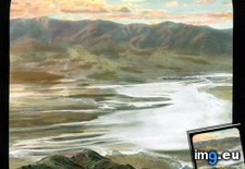
Pict. [Mapporn] Digital Elevation Model of the Contiguous United States [3375x2118] (#Model #States #United #Digital #Contiguous #Elevation)Pict. 3375×2118 px![[Mapporn] Digital Elevation Model of the Contiguous United States [3375x2118] (#Model #States #United #Digital #Contiguous #Elevation) - 900 KB Tags: contiguous, digital, elevation, model, states, united (Pict. in My r/MAPS favs)](https://t.im9.eu/mapporn-digital-elevation-model-of-the-contiguous-united-states-3375x2118.jpg) Pict. Death Valley, California - landscape at sunset from Dante's View (elevation - 5475 feet) (1920-1940).2288 (#Feet #California #Sunset #Elevation #Dante)Pict. 799×754 px
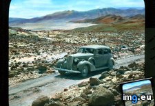
Pict. Death Valley, California - landscape at sunset from Dante's View (elevation - 5475 feet) (1920-1940).2288 (#Feet #California #Sunset #Elevation #Dante)Pict. 799×754 px Pict. Death Valley, California. Towne's Pass, State Route 190 - view of a car on the road through Panamint Range (elevation - 4956 fee (#California #Car #State #Valley #Route #Elevation #Fee #Panamint #Towne)Pict. 799×720 px
 GIF [Mapporn] Population and Elevation by US Contiguous County [1882x992] [GIF] (#Gif #Population #County #Contiguous #Elevation)GIF 1882×922 px
![[Mapporn] Population and Elevation by US Contiguous County [1882x992] [GIF] (#Gif #Population #County #Contiguous #Elevation) - 5 MB Tags: contiguous, county, elevation, gif, population (GIF in My r/MAPS favs)](https://t.im9.eu/mapporn-population-and-elevation-by-us-contiguous-county-1882x992-gif.jpg) Pict. [Mapporn] If San Francisco Crime were Elevation (500x803) (#San #Francisco #Crime #Elevation)Pict. 500×803 px
Pict. [Mapporn] If San Francisco Crime were Elevation (500x803) (#San #Francisco #Crime #Elevation)Pict. 500×803 px![[Mapporn] If San Francisco Crime were Elevation (500x803) (#San #Francisco #Crime #Elevation) - 114 KB Tags: crime, elevation, francisco, san (Pict. in My r/MAPS favs)](https://t.im9.eu/mapporn-if-san-francisco-crime-were-elevation-500x803.jpg) Pict. [Mapporn] Two Dimensional Digital Elevation Model and Earthquake Epicenter in Nepal [933x757] (#Model #Two #Digital #Nepal #Elevation #Earthquake)Pict. 933×757 px
Pict. [Mapporn] Two Dimensional Digital Elevation Model and Earthquake Epicenter in Nepal [933x757] (#Model #Two #Digital #Nepal #Elevation #Earthquake)Pict. 933×757 px![[Mapporn] Two Dimensional Digital Elevation Model and Earthquake Epicenter in Nepal [933x757] (#Model #Two #Digital #Nepal #Elevation #Earthquake) - 120 KB Tags: digital, earthquake, elevation, model, nepal, two (Pict. in My r/MAPS favs)](https://t.im9.eu/mapporn-two-dimensional-digital-elevation-model-and-earthquake-epicenter-in-nepal-933x757.jpg) Pict. [Mapporn] US elevation profile from LA to NYC [OC] [1139x442] (#Nyc #Elevation )Pict. 1139×442 px
Pict. [Mapporn] US elevation profile from LA to NYC [OC] [1139x442] (#Nyc #Elevation )Pict. 1139×442 px![[Mapporn] US elevation profile from LA to NYC [OC] [1139x442] (#Nyc #Elevation ) - 57 KB Tags: elevation, nyc (Pict. in My r/MAPS favs)](https://t.im9.eu/mapporn-us-elevation-profile-from-la-to-nyc-oc-1139x442.jpg) Pict. Rome. Colosseum - interior detail, elevation (1919-1938).3229 (#Interior #Detail #Rome #Elevation #Colosseum)Pict. 799×747 px
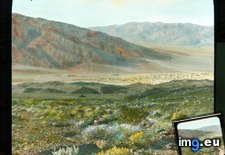
Pict. Rome. Colosseum - interior detail, elevation (1919-1938).3229 (#Interior #Detail #Rome #Elevation #Colosseum)Pict. 799×747 px Pict. Death Valley, California - sand dunes near Stovepipe Wells, view from Hell's Gate (elevation - 2263 feet) (1920-1940).2272 (#Feet #California #Valley #Dunes #Wells #Elevation #Stovepipe)Pict. 799×738 px
 Pict. [Mapporn] The Earth with Reversed Elevation[3476x1520] (#Earth #Elevation #Reversed)Pict. 3476×1520 px
![[Mapporn] The Earth with Reversed Elevation[3476x1520] (#Earth #Elevation #Reversed) - 978 KB Tags: earth, elevation, reversed (Pict. in My r/MAPS favs)](https://t.im9.eu/mapporn-the-earth-with-reversed-elevation-3476x1520.jpg)
★ 6128 pts. ♥ 0 likes ⬇ 12 saves
![[Mapporn] Mapping worldwide elevation using only data from airport locations [OC] [4000x2750] (#Data #Airport #Worldwide #Locations #Elevation #Mapping) - 1016 KB Tags: airport, data, elevation, locations, mapping, worldwide (Pict. in My r/MAPS favs)](https://t.im9.eu/mapporn-mapping-worldwide-elevation-using-only-data-from-airport-locations-oc-4000x2750.jpg) Pict. [Earthporn] The difference one day can make at Akkem Lake in the Altai Mountain Range, Siberia. Elevation: 2000m. [3066x2631] (#One #Day #Lake #Elevation #Siberia)Pict. 3066×2631 px
Pict. [Earthporn] The difference one day can make at Akkem Lake in the Altai Mountain Range, Siberia. Elevation: 2000m. [3066x2631] (#One #Day #Lake #Elevation #Siberia)Pict. 3066×2631 px★ 340k pts. ♥ 0 likes ⬇ 4 saves
![[Earthporn] The difference one day can make at Akkem Lake in the Altai Mountain Range, Siberia. Elevation: 2000m. [3066x2631] (#One #Day #Lake #Elevation #Siberia) - 1005 KB Tags: day, difference, elevation, lake, mountain, one, range, siberia (Pict. in My r/EARTHPORN favs)](https://t.im9.eu/earthporn-the-difference-one-day-can-make-at-akkem-lake-in-the-altai-mountain-range-siberia-elevation-2000m-3066x2631.jpg) Pict. [Mapporn] Civil War Map of New Orleans overlaid on a modern shaded elevation map. [OCish][1448x1571] (#Map #War #Elevation #Orleans #Overlaid)Pict. 1448×1571 px
Pict. [Mapporn] Civil War Map of New Orleans overlaid on a modern shaded elevation map. [OCish][1448x1571] (#Map #War #Elevation #Orleans #Overlaid)Pict. 1448×1571 px★ 5974 pts. ♥ 0 likes ⬇ 3 saves
![[Mapporn] Civil War Map of New Orleans overlaid on a modern shaded elevation map. [OCish][1448x1571] (#Map #War #Elevation #Orleans #Overlaid) - 483 KB Tags: civil, elevation, map, modern, orleans, overlaid, war (Pict. in My r/MAPS favs)](https://t.im9.eu/mapporn-civil-war-map-of-new-orleans-overlaid-on-a-modern-shaded-elevation-map-ocish-1448x1571.jpg) Pict. [Mapporn] Mean elevation of each state in the U.S. [OC] [2300x1500] (#State #Elevation )Pict. 2300×1500 px
Pict. [Mapporn] Mean elevation of each state in the U.S. [OC] [2300x1500] (#State #Elevation )Pict. 2300×1500 px★ 4246 pts. ♥ 0 likes ⬇ 3 saves
![[Mapporn] Mean elevation of each state in the U.S. [OC] [2300x1500] (#State #Elevation ) - 268 KB Tags: elevation, state (Pict. in My r/MAPS favs)](https://t.im9.eu/mapporn-mean-elevation-of-each-state-in-the-u-s-oc-2300x1500.jpg) Pict. [Mildlyinteresting] This Colorado village totals their establishment year, elevation, and population (#Year #Population #Elevation #Establishment #Totals)Pict. 768×1024 px
Pict. [Mildlyinteresting] This Colorado village totals their establishment year, elevation, and population (#Year #Population #Elevation #Establishment #Totals)Pict. 768×1024 px★ -9908 pts. ♥ 0 likes ⬇ 7 saves
![[Mildlyinteresting] This Colorado village totals their establishment year, elevation, and population (#Year #Population #Elevation #Establishment #Totals) - 126 KB Tags: colorado, elevation, establishment, population, totals, village, year (Pict. in My r/MILDLYINTERESTING favs)](https://t.im9.eu/mildlyinteresting-this-colorado-village-totals-their-establishment-year-elevation-and-population.jpg) Pict. [Mapporn] Distance between the highest natural elevation and the highest manmade elevation for each state [2160x1368] [OC] (#State #Natural #Distance #Highest #Elevation #Manmade)Pict. 2160×1368 px
Pict. [Mapporn] Distance between the highest natural elevation and the highest manmade elevation for each state [2160x1368] [OC] (#State #Natural #Distance #Highest #Elevation #Manmade)Pict. 2160×1368 px★ 6137 pts. ♥ 0 likes ⬇ 7 saves
![[Mapporn] Distance between the highest natural elevation and the highest manmade elevation for each state [2160x1368] [OC] (#State #Natural #Distance #Highest #Elevation #Manmade) - 268 KB Tags: distance, elevation, highest, manmade, natural, state (Pict. in My r/MAPS favs)](https://t.im9.eu/mapporn-distance-between-the-highest-natural-elevation-and-the-highest-manmade-elevation-for-each-state-2160x1368-oc.jpg) Pict. [Mapporn] US-Canada border elevation profile [OC] [1002x860] (#Canada #Elevation )Pict. 1002×860 px
Pict. [Mapporn] US-Canada border elevation profile [OC] [1002x860] (#Canada #Elevation )Pict. 1002×860 px★ 4295 pts. ♥ 0 likes ⬇ 3 saves
![[Mapporn] US-Canada border elevation profile [OC] [1002x860] (#Canada #Elevation ) - 147 KB Tags: canada, elevation (Pict. in My r/MAPS favs)](https://t.im9.eu/mapporn-us-canada-border-elevation-profile-oc-1002x860.jpg) Pict. [Earthporn] Mount Whitney, CA - Elevation 14,505, Prominence 10,079 - The highest point in the lower 48 states [2429x1619] (#States #Mount #Point #Highest #Whitney #Elevation)Pict. 2429×1619 px
Pict. [Earthporn] Mount Whitney, CA - Elevation 14,505, Prominence 10,079 - The highest point in the lower 48 states [2429x1619] (#States #Mount #Point #Highest #Whitney #Elevation)Pict. 2429×1619 px★ 339k pts. ♥ 0 likes ⬇ 6 saves
![[Earthporn] Mount Whitney, CA - Elevation 14,505, Prominence 10,079 - The highest point in the lower 48 states [2429x1619] (#States #Mount #Point #Highest #Whitney #Elevation) - 816 KB Tags: elevation, highest, mount, point, states, whitney (Pict. in My r/EARTHPORN favs)](https://t.im9.eu/earthporn-mount-whitney-ca-elevation-14-505-prominence-10-079-the-highest-point-in-the-lower-48-states-2429x1619.jpg) Pict. [Mapporn] Global elevation and shoreline data in Fuller Dymaxion form [5760x2880px]. Article and 43200x21600px TIFF in the comme (#Data #Form #Elevation #Comme #Shoreline)Pict. 5760×2880 px
Pict. [Mapporn] Global elevation and shoreline data in Fuller Dymaxion form [5760x2880px]. Article and 43200x21600px TIFF in the comme (#Data #Form #Elevation #Comme #Shoreline)Pict. 5760×2880 px★ 6256 pts. ♥ 0 likes ⬇ 6 saves
![[Mapporn] Global elevation and shoreline data in Fuller Dymaxion form [5760x2880px]. Article and 43200x21600px TIFF in the comme (#Data #Form #Elevation #Comme #Shoreline) - 632 KB Tags: article, comme, data, elevation, form, global, shoreline (Pict. in My r/MAPS favs)](https://t.im9.eu/mapporn-global-elevation-and-shoreline-data-in-fuller-dymaxion-form-5760x2880px-article-and-43200x21600px-tiff-in-the-comments.jpg) Pict. [Mapporn] Digital Elevation Model of the Contiguous United States [3375x2118] (#Model #States #United #Digital #Contiguous #Elevation)Pict. 3375×2118 px
Pict. [Mapporn] Digital Elevation Model of the Contiguous United States [3375x2118] (#Model #States #United #Digital #Contiguous #Elevation)Pict. 3375×2118 px★ 6440 pts. ♥ 0 likes ⬇ 8 saves
![[Mapporn] Digital Elevation Model of the Contiguous United States [3375x2118] (#Model #States #United #Digital #Contiguous #Elevation) - 900 KB Tags: contiguous, digital, elevation, model, states, united (Pict. in My r/MAPS favs)](https://t.im9.eu/mapporn-digital-elevation-model-of-the-contiguous-united-states-3375x2118.jpg) Pict. Death Valley, California - landscape at sunset from Dante's View (elevation - 5475 feet) (1920-1940).2288 (#Feet #California #Sunset #Elevation #Dante)Pict. 799×754 px
Pict. Death Valley, California - landscape at sunset from Dante's View (elevation - 5475 feet) (1920-1940).2288 (#Feet #California #Sunset #Elevation #Dante)Pict. 799×754 px★ 10k pts. ♥ 0 likes ⬇ 3 saves
 Pict. Death Valley, California. Towne's Pass, State Route 190 - view of a car on the road through Panamint Range (elevation - 4956 fee (#California #Car #State #Valley #Route #Elevation #Fee #Panamint #Towne)Pict. 799×720 px
★ 11k pts. ♥ 0 likes ⬇ 7 saves
 GIF [Mapporn] Population and Elevation by US Contiguous County [1882x992] [GIF] (#Gif #Population #County #Contiguous #Elevation)GIF 1882×922 px
★ 5900 pts. ♥ 0 likes ⬇ 2 saves
![[Mapporn] Population and Elevation by US Contiguous County [1882x992] [GIF] (#Gif #Population #County #Contiguous #Elevation) - 5 MB Tags: contiguous, county, elevation, gif, population (GIF in My r/MAPS favs)](https://t.im9.eu/mapporn-population-and-elevation-by-us-contiguous-county-1882x992-gif.jpg) Pict. [Mapporn] If San Francisco Crime were Elevation (500x803) (#San #Francisco #Crime #Elevation)Pict. 500×803 px
Pict. [Mapporn] If San Francisco Crime were Elevation (500x803) (#San #Francisco #Crime #Elevation)Pict. 500×803 px★ 5124 pts. ♥ 0 likes ⬇ 5 saves
![[Mapporn] If San Francisco Crime were Elevation (500x803) (#San #Francisco #Crime #Elevation) - 114 KB Tags: crime, elevation, francisco, san (Pict. in My r/MAPS favs)](https://t.im9.eu/mapporn-if-san-francisco-crime-were-elevation-500x803.jpg) Pict. [Mapporn] Two Dimensional Digital Elevation Model and Earthquake Epicenter in Nepal [933x757] (#Model #Two #Digital #Nepal #Elevation #Earthquake)Pict. 933×757 px
Pict. [Mapporn] Two Dimensional Digital Elevation Model and Earthquake Epicenter in Nepal [933x757] (#Model #Two #Digital #Nepal #Elevation #Earthquake)Pict. 933×757 px★ 5717 pts. ♥ 0 likes ⬇ 11 saves
![[Mapporn] Two Dimensional Digital Elevation Model and Earthquake Epicenter in Nepal [933x757] (#Model #Two #Digital #Nepal #Elevation #Earthquake) - 120 KB Tags: digital, earthquake, elevation, model, nepal, two (Pict. in My r/MAPS favs)](https://t.im9.eu/mapporn-two-dimensional-digital-elevation-model-and-earthquake-epicenter-in-nepal-933x757.jpg) Pict. [Mapporn] US elevation profile from LA to NYC [OC] [1139x442] (#Nyc #Elevation )Pict. 1139×442 px
Pict. [Mapporn] US elevation profile from LA to NYC [OC] [1139x442] (#Nyc #Elevation )Pict. 1139×442 px★ 4264 pts. ♥ 0 likes ⬇ 6 saves
![[Mapporn] US elevation profile from LA to NYC [OC] [1139x442] (#Nyc #Elevation ) - 57 KB Tags: elevation, nyc (Pict. in My r/MAPS favs)](https://t.im9.eu/mapporn-us-elevation-profile-from-la-to-nyc-oc-1139x442.jpg) Pict. Rome. Colosseum - interior detail, elevation (1919-1938).3229 (#Interior #Detail #Rome #Elevation #Colosseum)Pict. 799×747 px
Pict. Rome. Colosseum - interior detail, elevation (1919-1938).3229 (#Interior #Detail #Rome #Elevation #Colosseum)Pict. 799×747 px★ 9725 pts. ♥ 0 likes ⬇ 3 saves
 Pict. Death Valley, California - sand dunes near Stovepipe Wells, view from Hell's Gate (elevation - 2263 feet) (1920-1940).2272 (#Feet #California #Valley #Dunes #Wells #Elevation #Stovepipe)Pict. 799×738 px
★ 11k pts. ♥ 0 likes ⬇ 6 saves
 Pict. [Mapporn] The Earth with Reversed Elevation[3476x1520] (#Earth #Elevation #Reversed)Pict. 3476×1520 px
★ 4629 pts. ♥ 0 likes ⬇ 3 saves
![[Mapporn] The Earth with Reversed Elevation[3476x1520] (#Earth #Elevation #Reversed) - 978 KB Tags: earth, elevation, reversed (Pict. in My r/MAPS favs)](https://t.im9.eu/mapporn-the-earth-with-reversed-elevation-3476x1520.jpg)