★ 9582 pts. ♥ 0 likes ⬇ 4 saves
![[Mapporn] Human ooze: World population density by latitude-longitude, with traditional chart axis flipped [OC] [1500x765] - 225 KB Tags: axis, chart, density, flipped, human, latitude, longitude, ooze, population, traditional, world (Pict. in My r/MAPS favs)](http://t.im9.eu/mapporn-human-ooze-world-population-density-by-latitude-longitude-with-traditional-chart-axis-flipped-oc-1500x765.jpg) Full [Mapporn] Manuscript Japanese Chart -southern coast to Ogasawara islands(?) 2730 x 3666Pict. 2730×3666 px
Full [Mapporn] Manuscript Japanese Chart -southern coast to Ogasawara islands(?) 2730 x 3666Pict. 2730×3666 px★ 7014 pts. ♥ 0 likes ⬇ 7 saves
![[Mapporn] Manuscript Japanese Chart -southern coast to Ogasawara islands(?) 2730 x 3666 - 992 KB Tags: chart, coast, islands, japanese, manuscript, ogasawara, southern (Pict. in My r/MAPS favs)](http://t.im9.eu/mapporn-manuscript-japanese-chart-southern-coast-to-ogasawara-islands-2730-x-3666.jpg) Full [Mapporn] [OS] Moral & political chart of the inhabited world (1821)[5609x3479]Pict. 5609×3479 px
Full [Mapporn] [OS] Moral & political chart of the inhabited world (1821)[5609x3479]Pict. 5609×3479 px★ 6086 pts. ♥ 0 likes ⬇ 3 saves
![[Mapporn] [OS] Moral & political chart of the inhabited world (1821)[5609x3479] - 4 MB Tags: chart, moral, political, world (Pict. in My r/MAPS favs)](http://t.im9.eu/mapporn-os-moral-political-chart-of-the-inhabited-world-1821-5609x3479.jpg) Full [Mildlyinteresting] I went into a fitting room that had a celebrity height chartPict. 2448×3264 px
Full [Mildlyinteresting] I went into a fitting room that had a celebrity height chartPict. 2448×3264 px★ -8374 pts. ♥ 0 likes ⬇ 9 saves
![[Mildlyinteresting] I went into a fitting room that had a celebrity height chart - 673 KB Tags: celebrity, chart, fitting, height, room (Pict. in My r/MILDLYINTERESTING favs)](http://t.im9.eu/mildlyinteresting-i-went-into-a-fitting-room-that-had-a-celebrity-height-chart.jpg) Full [Dataisbeautiful] This chart of the number of Google hits of every date of the year looks like a skylinePict. 487×341 px
Full [Dataisbeautiful] This chart of the number of Google hits of every date of the year looks like a skylinePict. 487×341 px★ 5440 pts. ♥ 0 likes ⬇ 4 saves
![[Dataisbeautiful] This chart of the number of Google hits of every date of the year looks like a skyline - 22 KB Tags: chart, google, hits, number, skyline, year (Pict. in My r/DATAISBEAUTIFUL favs)](http://t.im9.eu/dataisbeautiful-this-chart-of-the-number-of-google-hits-of-every-date-of-the-year-looks-like-a-skyline.jpg) Full [Mapporn] A Detailed Navigation Chart Of The Narrow Seas from 1672 - By John Seller, The King's Hydrographer [4061x3384]Pict. 4061×3384 px
Full [Mapporn] A Detailed Navigation Chart Of The Narrow Seas from 1672 - By John Seller, The King's Hydrographer [4061x3384]Pict. 4061×3384 px★ 6274 pts. ♥ 0 likes ⬇ 9 saves
![[Mapporn] A Detailed Navigation Chart Of The Narrow Seas from 1672 - By John Seller, The King's Hydrographer [4061x3384] - 2.1 MB Tags: chart, detailed, john, king, narrow, seller (Pict. in My r/MAPS favs)](http://t.im9.eu/mapporn-a-detailed-navigation-chart-of-the-narrow-seas-from-1672-by-john-seller-the-king-s-hydrographer-4061x3384.jpg) Full [Wtf] For all the new couples, a quick chart to clear some things up.Pict. 500×667 px
Full [Wtf] For all the new couples, a quick chart to clear some things up.Pict. 500×667 px★ 5020 pts. ♥ 0 likes ⬇ 8 saves
![[Wtf] For all the new couples, a quick chart to clear some things up. - 59 KB Tags: all, chart, clear, couples, for, new, quick, wtf (Pict. in My r/WTF favs)](http://t.im9.eu/wtf-for-all-the-new-couples-a-quick-chart-to-clear-some-things-up.jpg) Full [Mapporn] Lunar Earthside Chart [6105x4277]Pict. 6105×4277 px
Full [Mapporn] Lunar Earthside Chart [6105x4277]Pict. 6105×4277 px★ 5351 pts. ♥ 0 likes ⬇ 6 saves
![[Mapporn] Lunar Earthside Chart [6105x4277] - 3.5 MB Tags: chart, lunar (Pict. in My r/MAPS favs)](http://t.im9.eu/mapporn-lunar-earthside-chart-6105x4277.jpg) Full [Mapporn] Abba single with longest chart run in European countries [1340x1256] [OC]Pict. 1340×1256 px
Full [Mapporn] Abba single with longest chart run in European countries [1340x1256] [OC]Pict. 1340×1256 px★ 7753 pts. ♥ 0 likes ⬇ 9 saves
![[Mapporn] Abba single with longest chart run in European countries [1340x1256] [OC] - 190 KB Tags: abba, chart, countries, european, longest, run, single (Pict. in My r/MAPS favs)](http://t.im9.eu/mapporn-abba-single-with-longest-chart-run-in-european-countries-1340x1256-oc.jpg) Full [Dataisbeautiful] Crayola Color Chart, 1903-2010Pict. 800×800 px
Full [Dataisbeautiful] Crayola Color Chart, 1903-2010Pict. 800×800 px★ 3244 pts. ♥ 0 likes ⬇ 5 saves
![[Dataisbeautiful] Crayola Color Chart, 1903-2010 - 93 KB Tags: chart, color, crayola (Pict. in My r/DATAISBEAUTIFUL favs)](http://t.im9.eu/dataisbeautiful-crayola-color-chart-1903-2010.jpg) Full maps-and-keys-chartPict. 603×735 px
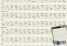
Full maps-and-keys-chartPict. 603×735 px★ 4182 pts. ♥ 0 likes ⬇ 9 saves
 Full [Mapporn] Bathymetric chart of the Arctic Ocean (link to full-res pdf in comments) [4200x5200]Pict. 2016×2496 px
★ 6336 pts. ♥ 0 likes ⬇ 11 saves
![[Mapporn] Bathymetric chart of the Arctic Ocean (link to full-res pdf in comments) [4200x5200] - 826 KB Tags: arctic, chart, full, ocean, res (Pict. in My r/MAPS favs)](http://t.im9.eu/mapporn-bathymetric-chart-of-the-arctic-ocean-link-to-full-res-pdf-in-comments-4200x5200.jpg) Full Female Body Types ChartPict. 874×914 px
Full Female Body Types ChartPict. 874×914 px★ 8239 pts. ♥ 0 likes ⬇ 5 saves
 Full Chart.apis.google.com Chart?chf=bg,s,ffffff Chs=380x380 Cht=qr Chld=|1 Chl=http 3a 2f 2fwhoerPict. 380×380 px
★ 7545 pts. ♥ 0 likes ⬇ 10 saves
 Full Chart.apis.google.com Chart?chf=bg,s,ffffff Chs=380x380 Cht=qr Chld=|1 Chl=http 3a 2f 2flinkPict. 380×380 px
★ 6752 pts. ♥ 0 likes ⬇ 7 saves
 Full [Dataisbeautiful] A chart of when, and how long our refrigerator has been openPict. 1917×801 px
★ 3806 pts. ♥ 0 likes ⬇ 3 saves
![[Dataisbeautiful] A chart of when, and how long our refrigerator has been open - 370 KB Tags: chart, long, refrigerator (Pict. in My r/DATAISBEAUTIFUL favs)](http://t.im9.eu/dataisbeautiful-a-chart-of-when-and-how-long-our-refrigerator-has-been-open.jpg) Full [Funny] Caffeinated owl chart.Pict. 660×560 px
Full [Funny] Caffeinated owl chart.Pict. 660×560 px★ 3640 pts. ♥ 0 likes ⬇ 10 saves
![[Funny] Caffeinated owl chart. - 68 KB Tags: caffeinated, chart, funny, owl (Pict. in My r/FUNNY favs)](http://t.im9.eu/funny-caffeinated-owl-chart.jpg) Full [Dataisbeautiful] Global Browser Market Share (Bump Chart!)Pict. 2000×2000 px
Full [Dataisbeautiful] Global Browser Market Share (Bump Chart!)Pict. 2000×2000 px★ 4714 pts. ♥ 0 likes ⬇ 13 saves
![[Dataisbeautiful] Global Browser Market Share (Bump Chart!) - 206 KB Tags: browser, bump, chart, global, market, share (Pict. in My r/DATAISBEAUTIFUL favs)](http://t.im9.eu/dataisbeautiful-global-browser-market-share-bump-chart.jpg) Full Baratone (DGBE) UKULELE Chords ChartPict. 1099×1759 px
Full Baratone (DGBE) UKULELE Chords ChartPict. 1099×1759 px★ -289 pts. ♥ 0 likes ⬇ 5 saves
 Full [Mapporn] Rebbilib, a traditional Polynesian stick chart used for ocean navigation, circa 1900, Marshall Islands. [837×768]Pict. 837×768 px
★ 8609 pts. ♥ 0 likes ⬇ 8 saves
![[Mapporn] Rebbilib, a traditional Polynesian stick chart used for ocean navigation, circa 1900, Marshall Islands. [837×768] - 59 KB Tags: chart, circa, islands, marshall, navigation, ocean, polynesian, rebbilib, stick, traditional (Pict. in My r/MAPS favs)](http://t.im9.eu/mapporn-rebbilib-a-traditional-polynesian-stick-chart-used-for-ocean-navigation-circa-1900-marshall-islands-837-768.jpg) Full Chart.apis.google.com Chart?chf=bg,s,ffffff Chs=380x380 Cht=qr Chld=|1 Chl=https 3a 2f 2fwww.youtubePict. 380×380 px
Full Chart.apis.google.com Chart?chf=bg,s,ffffff Chs=380x380 Cht=qr Chld=|1 Chl=https 3a 2f 2fwww.youtubePict. 380×380 px★ 8287 pts. ♥ 0 likes ⬇ 11 saves
 Full [Mildlyinteresting] Google trend chart for 'harlem shake'Pict. 821×505 px
★ -9790 pts. ♥ 0 likes ⬇ 3 saves
![[Mildlyinteresting] Google trend chart for 'harlem shake' - 26 KB Tags: chart, google, harlem, shake, trend (Pict. in My r/MILDLYINTERESTING favs)](http://t.im9.eu/mildlyinteresting-google-trend-chart-for-harlem-shake.jpg) Full [Dataisbeautiful] I got bored of the (American Football) off season and made a chart showing when it's probably safe to go grab Pict. 720×540 px
Full [Dataisbeautiful] I got bored of the (American Football) off season and made a chart showing when it's probably safe to go grab Pict. 720×540 px★ 7820 pts. ♥ 0 likes ⬇ 9 saves
![[Dataisbeautiful] I got bored of the (American Football) off season and made a chart showing when it's probably safe to go grab - 73 KB Tags: american, bored, chart, football, grab, safe, season, showing (Pict. in My r/DATAISBEAUTIFUL favs)](http://t.im9.eu/dataisbeautiful-i-got-bored-of-the-american-football-off-season-and-made-a-chart-showing-when-it-s-probably-safe-to-go-grab-a-beer-without-missing-part-of-touch-down-drive-nfl.jpg) Full [Dataisbeautiful] Chart redraw: Troops Vs. Cost from 1980-2012 (Time Magazine) [ Or, a clean dataset with two 'beautiful' interpPict. 969×1053 px
Full [Dataisbeautiful] Chart redraw: Troops Vs. Cost from 1980-2012 (Time Magazine) [ Or, a clean dataset with two 'beautiful' interpPict. 969×1053 px★ 7312 pts. ♥ 0 likes ⬇ 9 saves
![[Dataisbeautiful] Chart redraw: Troops Vs. Cost from 1980-2012 (Time Magazine) [ Or, a clean dataset with two 'beautiful' interp - 85 KB Tags: beautiful, chart, clean, cost, dataset, interp, magazine, redraw, time, troops, two (Pict. in My r/DATAISBEAUTIFUL favs)](http://t.im9.eu/dataisbeautiful-chart-redraw-troops-vs-cost-from-1980-2012-time-magazine-or-a-clean-dataset-with-two-beautiful-interpretations-one-clearly-superior-to-the-other-as-far-as-telling-a-meaningful-quantitative-story-1.jpg)